|
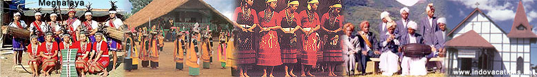
Don Bosco Centre for Indigenous Cultures
The Don Bosco Museum is part of DBCIC (Don Bosco
Centre for Indigenous Cultures). DBCIC comprises research
on cultures, publications, training, animation programmes
and the museum, which is a place of knowledge-sharing on
the cultures of the northeast in particular, and of
culture in general. DBCIC with its Don Bosco Museum is
situated at Mawlai, Shillong.
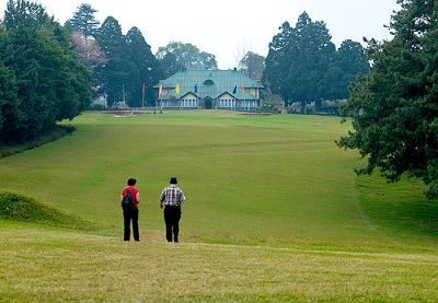
Shillong Golf Course
Shillong has one of the largest golf courses (the
world's wettest) in Asia. It enjoys the rare distinction
of being one of the few natural golf courses in Asia.
Shillong Golf Course is not only scenic and enjoyable but
it is also challenging. A group of British civil service
officers introduced golf to Shillong in 1898 by
constructing a nine-hole course. The present 18-hole
course was launched in 1924. The course is set in a valley
which is covered with pine and rhododendron trees.
Shillong Golf Course is considered to be the "Glen Eagle
of the East" at the United States Golf Association Museum.
It is located in a valley at an elevation of 5200 ft in
1898 as a nine-hole course and later converted into a
18-hole course in 1924 by Captain Jackson and C. K.
Rhodes.
Chrysalis the Gallery
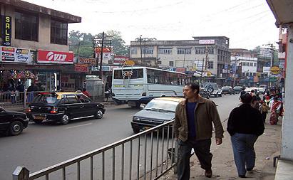
This art gallery is on the second floor of Salonsar
Mansion at Police Bazaar,it is the commercial hub of
Shillong. Chrysalis has flexible spacing to display
paintings (canvases), sculpture, photography and
handicrafts. Run by a local artist, Jaya Kalra, the
gallery caters to exhibitions of artists and artisans
especially from the northeast and also from the rest of
India.
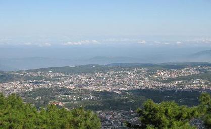
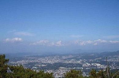
Shillong Peak
Shillong Peak is a picnic spot which is about 10 km
from the city, 1965 m above sea level, it offers a
panoramic view of the scenic countryside and is the
highest point in the state. Obeisance is paid to U Shulong
at the sanctum sanctorum at the peak's summit every
springtime, by the religious priest of Mylliem State.
Elephant Falls
Elephant Falls are about 12 km on the outskirts of the
city, the mountain stream descends through two successive
falls set in dells of fern covered rocks.
Lady Hydari Park
The park extends over a kilometre and has an nearby
mini zoo.
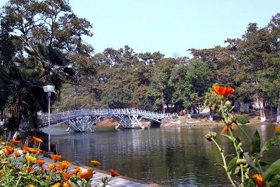
Wards Lake
Wards Lake is famous locally as Nan-Polok. Its an
artificial lake with garden and boating facilities.
Motphran
Motphran is known as the “Stone of France” which is
locally known as "Motphran" was erected in memory of the
26th Khasi Labour Corps who served under the British in
France during World War I. It bears the words of the
famous Latin poet Horace "Dulce et decorum est pro patria
mori" which can be roughly translated as "It is sweet and
fitting to die for one's country."
Bishop and Beadon Falls
Both cascade down the same escarpment into a deep
valley.
Capt. Williamson Sangma State Museum
This government museum offers insights to the
lifestyle of the people. This museum is in the State
Central Library complex where monuments for the great
patriots of the state were erected besides the statue of
Smt. Indira Gandhi and Netaji Subhash Chandra Bose.
Spread Eagle Falls
Spread Eagle Falls are located about 3 km from Polo
Grounds.
Sweet Falls
Sweet Falls (also called “Weitden,” in the native
dialect) is the most wonderful of all the waterfalls in
Shillong. It lies about 5 km from the Happy Valley and is
about 96 m in height.
Entomological Museum (Butterfly Museum)
It is a privately owned museum of M/s Wankhar,
Riatsamthiah, Shillong about 2 km from Police Bazar is the
only known museum in India devoted to moths and
butterflies.
State Museum
State Museum is Located at the State
Central Library complex.
Crinoline Falls
Crinoline Falls are located near Lady
Hydari Park. |