|
About Manebhanjang |
|
Manebhanjang (2150 m) is a village in the Darjeeling Sadar
subdivision, Darjeeling district in the state of West Bengal
in India. It is situated at the gateway of the Singalila
National Park which is about 28 km away from Darjeeling town.
The income of the local residents is geared towards tourism,
especially foreign trekkers. Mane Bhanjyang is the start of
the trailhead for the trek to Sandakphu on the Singalila Ridge
which is the highest point in West Bengal. Conveyance for
Sandakphu is also available mainly from
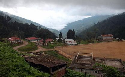
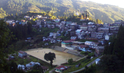
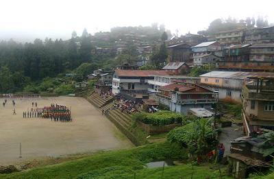
Manebhanjang village has a large playground where a football
tournament is organised every year during the Independence Day
of India. Maneybhanjang is located at an elevation of 6600 ft
above sea level on the Indo-Nepal border.. The two countries
are separated by a small drain covered with a culvert, which
also acts as a motor stand for vehicles carrying people to
Sukhiapokhri. This small valley is a residence of about 5oo
households with an population of about 6ooo.
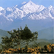
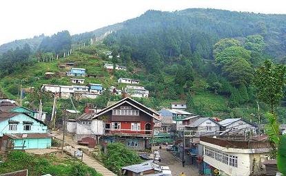
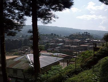
Despite being a crowded market Manebhanjang provides a
panoramic view of the magnificent Kunchanjungha Mountains over
Darjeeling hills. The view of illuminated Darjeeling town at
night from Manebhanjang is also very striking. There is a
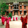
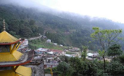
small monastery overlooking the huge Darjeeling valley which
is a nice place for a short stroll.
Foreigners have to show their Passport and Visa at the
Foreigners' Check Post at Manebhanjang.
The main economy here is based on tourism. Regular jeep
safaris take place from here to the nearby areas including
Sandakphu and the Singalila National Park. Manebhanjang is one
place where one still finds the old 4-wheel drive Land Rovers
that were once used during the British days. These vehicles
are ideally suited to climb the steep gravel road that leads
up to Sandakphu. Only handful of such Land Rovers are still
remaining in this area and are maintained by their owners like
their own siblings.
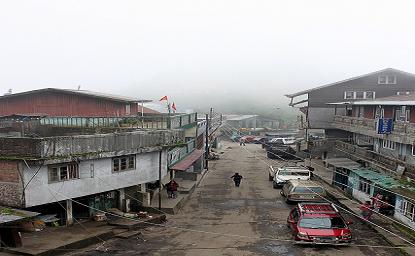
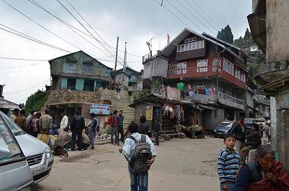
The main market area of Manebhanjang gets fairly crowded
during the day time. There is also a jeep and a bus stand
here. A playground is situated a short distance away where
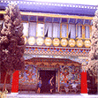
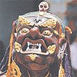
soccer tournaments are held on special occasions. Up on the
hills, there is a nice colorful monastery amongst pine trees. |
|
| |
|
Geography of Manebhanjang |
|
Manebhanjang is located at an average elevation of 2150 m in the
Darjeeling Himalayan hill Region in the Singalila Ridge, the
highest point of West Bengal. These hills are a part of the
Mahabharat Range or Lesser Himalaya. The soil is mainly composed
of sandstone and conglomerate formations, which are the
solidified and upheaved detritus of the greater range of
Himalaya. However, the soil is often poorly combined (the
permeable sediments of the region do not retain water between
rains) and is not considered suitable for agriculture. The area
has steep slopes and loose topsoil, leading to frequent
landslides during the monsoons. According to the bureau of
Indian Standards, the area in which the village lies falls under
seismic zone-IV (on a scale of I to V, in order of increasing
proneness to earthquakes) near the convergent boundary of the
Indian and the Eurasian tectonic plates and is subject to
frequent earthquakes. The geographical co-ordinates of the
village are 26.98°N 88.11°E.
Manebhanjang is bounded by some small villages within a radius
of 5–8 km. Being a border of Nepal and India, the Friday Market
or the "haat" brings the whole population of the area together
for various household and business purposes. |
|
| |
|
How to Reach Manebhanjang |
|
Manebhanjang can be reached directly from New Jalpaiguri
railway station where hired vehicles are available, although
the number of vehicles are limited. Most vehicles are
available from 4am to 6am. From Siliguri, shared and
non-shared taxis operate directly for Manebhanjang. One can
also avail taxis for Rimbick from Siliguri and Darjeeling,
which travel via Manebhanjang. Another option is to take
vehicle en route to Darjeeling and drop at Ghoom. Conveyance
is available from Ghoom to Sukhiapokhri and then from
Sukhiapokhri to Manebhanjang. Manebhanjang is the last point
or base came for trekkers heading toward Sandakphu and Phalut.
All required accessories and stuffs required during the 2–4
days trek is available here. The famous Rhododendron trek and
the Himalayan Run & Trek are organised from here. |
|
|
|
|
|
|
|
|
|