|
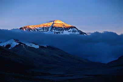
About Mount Everest |
|
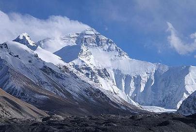
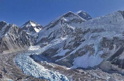
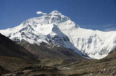
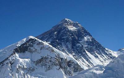
Mount Everest is the Earth's highest mountain, with a peak at
8,848 metres (29,029 ft) above sea level and the 5th tallest
mountain measured from the centre of the Earth. It is situated
in the Mahalangur section of the Himalayas. The international
border between China and Nepal runs across the particular
summit point. Its massif includes adjacent peaks Changtse,
7,580 m (24,870 ft) ; Nuptse, 7,855 m (25,771 ft) and Lhotse,
8,516 m (27,940 ft).
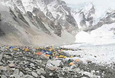
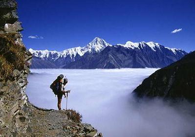
Mount Everest attracts many highly experienced mountaineers as
well as competent climbers willing to hire professional
guides. There are two main climbing routes, one approaching
the summit from the southeast in Nepal (known as the standard
route) and the other from the north in Tibet. While not posing
considerable technical climbing challenges on the standard
route, Everest presents dangers such as altitude sickness,
weather, wind as well as major objective dangers from
landslides and the Khumbu Icefall. While the vast majority of
climbers will use bottled oxygen in order to reach the top,
some climbers have summitted Everest without supplemental
oxygen.
The goal of reaching Everest's summit for the first time was
initially taken up by persistent British mountaineers. With
Nepal not allowing foreigners into the country at the time,
the British made some attempts on the north ridge route from
the Tibetan side. After the first reconnaissance expedition by
the British in 1921 reached 7,000 m (22,970 ft) on the North
Col, the 1922 journey pushed the North ridge route up to 8,320
m (27,300 ft) marking the first time a human had climbed above
8,000 m (26,247 ft). Tragedy struck on the descent from the
North col when seven porters were killed in a landslide. The
1924 expedition resulted in the greatest mystery on Everest to
this day: George Mallory and Andrew Irvine made a final summit
attempt on June 8 but never returned. They had been spotted
high on the mountain that day but disappeared in the clouds,
never to be seen again until Mallory's body was found in 1999
at 8,155 m (26,755 ft) on the North face. Tenzing Norgay and
Edmund Hillary made the first official ascent of Everest in
1953 using the southeast ridge route. Tenzing had reached
8,595 m (28,199 ft) the previous year as a member of the 1952
Swiss expedition.
In 1856, the Great Trigonometric Survey of British India
founded the first published height of Everest, then known as
Peak XV, at 29,002 ft (8,840 m). The current official height
of 8,848 m (29,029 ft) as recognized by China and Nepal was
established by a 1955 Indian survey and then confirmed by a
Chinese survey in 1975. In 1865, Everest was given its
official English name by the Royal Geographical Society upon a
recommendation by Andrew Waugh, the British Surveyor General
of India. Waugh named the mountain after his predecessor in
the post, Sir George Everest. Although Tibetans had called
Everest "Chomolungma" for centuries, Waugh was unaware of this
because Tibet and Nepal were closed to foreigners at the time
thus preventing any attempts to obtain local names.
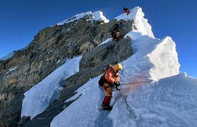
Climbing
Because Mount Everest is the highest mountain in the world, it
has attracted substantial attention and climbing attempts. A
set of climbing routes has been founded, and the risks in
climbing are well known.
Routes
Mt. Everest has two main climbing routes, the southeast ridge
from Nepal and the north ridge from Tibet, as well as many
other less frequently climbed routes. Of the two main routes,
the southeast ridge is technically easier and is the more
frequently used route. It was the route which was used by
Tenzing Norgay and Edmund Hillary in 1953 and the first
recognized of fifteen routes to the top by 1996. This was,
however, a route decision dictated more by politics than by
plan as the Chinese border was closed to the western world in
the 1950s after the People's Republic of China invaded Tibet. |
|
| |
|
Flora and Fauna |
|
Euophrys omnisuperstes, a minute black jumping spider, has been
found at heights as high as 6,700 metres (22,000 ft), probably
making it the highest confirmed non-microscopic permanent
resident on Earth. It lurks in gaps and may feed on frozen
insects that have been blown there by the wind. It should be
noted that there is a high likelihood of microscopic life at
even higher heights.
Birds, such as the Bar-headed Goose, have been seen flying at
the higher elevations of the mountain, while others, such as the
Chough, have been spotted as high as the South Col at 7,920
metres (25,980 ft) scavenging on food, or even corpses, left by
prior climbing expeditions. There is a moss that grows at 6,480
metres (21,260 ft) on Mount Everest. It may be the highest
altitude plant species. |
|
| |
|
Mythological significance |
|
The
southern part of Mt. Everest is considered as one of several
"hidden valleys" of refuge designated by Padmasambhava, a
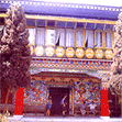
ninth-century "lotus-born" Buddhist saint.Near the base of the
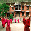
north side of Mt. Everest lies Rongbuk Monastery, which is the
"holy entrance to Mount Everest", with the most dramatic views
of the world. For Sherpas living on the slopes of Everest in the
Khumbu region of Nepal, Rongbuk Monastery was a significant
pilgrimage site, accessed in a few days of travel across the
Himalaya through Nangpa La.
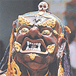
Miyolangsangma, a Tibetan Buddhist "Goddess of Inexhaustible
Giving", is considered to have lived at the top of Mt. Everest.
According to Sherpa Buddhist monks, Mt. Everest is
Miyolangsangma's palace and playground, and all climbers are
only partly welcome guests, having arrived without invitation.
The Sherpa people also believe that Mt. Everest and its flanks
are blessed with religious energy, and one should show amazement
when passing through this holy landscape. Here, the karmic
effects of one's actions are magnified, and impure thoughts are
best avoided. |
|
|
|
|
Geology |
|
Geologists have subdivided the rocks comprising Mount
Everest into three units called "formations". Each
formation is separated from the other by low-angle faults,
called "detachments", along which they have been thrust
over each other. From the summit of Mount Everest to its
base these rock units are the Qomolangma Formation, the
North Col formation, and the Rongbuk Formation.
From its summit to the top of the Yellow Band, about 8,600
m (28,000 ft) above sea level, the top of Mount Everest
consists of the Qomolangma Formation, which has also been
assigned as either the Everest Formation or Jolmo Lungama
Formation. It consists of grayish to dark gray or white,
parallel laminated and bedded, Ordovician limestone inter
layered with subsidiary beds of recrystallized dolomite
with argillaceous laminae and siltstone. Gansser first
reported finding microscopic pieces of crinoids in this
limestone. Later petrographic analysis of samples of the
limestone from near the peak disclosed them to be composed
of carbonate pellets and thinly fragmented remains of
crinoids, ostracods and trilobites. Other samples were so
imperfectly sheared and recrystallized that their original
constituents could not be determined. A thick,
white-weathering thrombolitebed that is 60 m (200 ft)
thick contains the foot of the "Third Step", and base of
the summit pyramid of Everest. This bed, which crops out
starting about 70 m (300 ft) below the peak of Mount
Everest, consists of residues trapped, bound, and cemented
by the biofilms of micro-organisms, mainly cyanobacteria,
in shallow marine waters. The Qomolangma Formation is
broken up by several high-angle faults that terminate at
the low angle thrust fault, the Qomolangma Detachment.
This detachment separates it from the underlying Yellow
Band. The lower five meters of the Qomolangma Formation
overlying this aloofness are very highly deformed.
The bulk of Mount Everest, between 7,000 and 8,600 m
(23,000 and 28,200 ft), consists of the North Col
Formation, of which the Yellow Band forms its upper part
between 8,200 to 8,600 m (26,900 to 28,200 ft). The Yellow
Band consists of intercalated beds of Middle Cambrian
diopside-epidote-bearing marble, which withstands a unique
yellowish brown, and muscovite-biotite phyllite and
semischist. Petrographic analysis of marble
collected from about 8,300 m (27,200 ft) found it to
consist as much as five percent of the ghosts of
recrystallized crinoid ossicles. The upper five meters of
the Yellow Band lying nearby to the Qomolangma Detachment
is badly distorted. A 5–40 cm (2–16 in) thick fault
breccia separates it from the overlying Qomolangma
Formation.
The rest of the North Col Formation, exposed between 7,000
to 8,200 m (23,000 to 26,900 ft) on Mount Everest,
consists of interlayered and collapsed schist, phyllite,
and minor marble. Between 7,600 and 8,200 m (24,900 and
26,900 ft), the North Col Formation consists mainly of
biotite-quartz phyllite and chlorite-biotite phyllite
intercalated with minor amounts of biotite-sericite-quartz
schist. Between 7,000 and 7,600 m (23,000 and 24,900 ft),
the lower part of the North Col Formation consists of
biotite-quartz schist intercalated with epidote-quartz
schist, biotite-calcite-quartz schist, and thin layers of
quartzose marble. These metamorphic rocks appear to be the
result of the metamorphism of Middle to Early Cambrian
deep sea flysch composed of interbedded, mudstone, clayey
sandstone, shale, calcareous sandstone, sandy limestone ,
and graywacke. The base of the North Col Formation is a
regional thrust fault called the "Lhotse detachment".
Below 7,000 m (23,000 ft), the Rongbuk Formation underlies
the North Col Formation and forms the base of Mount
Everest. It consists of sillimanite-K-feldspar grade
schist and gneiss imposed by various dikes and sills of
leucogranite ranging in thickness from 1 cm to 1,500 m
(0.4 in to 4,900 ft). These leucogranites are part of a
belt of Late Oligocene–Miocene invasive rocks known as the
Higher Himalayan leucogranite. They formed as the result
of partial melting of Paleoproterozoic to Ordovician
high-grade metasedimentary rocks of the Higher Himalayan
Sequence about 20 to 24 million years ago during the
subduction of the Indian Plate. |
|
|
|
|
Environment of Mount Everest |
|
Besides rubbish, the degradation on Himalayan peaks and other
issues concerned long-time Everest guide and climber Apa Sherpa.
He said when he first started climbing Everest, the trail to the
summit was covered with ice and snow. But it is now dotted with
bare rocks. The melting ice has also exposed deep crevasses,
making expeditions more dangerous.Apa organized an expedition to
remove 4,000 kg (8,800 lb) of rubbish from the lower part of the
mountain and another 1,000 kg (2,200 lb) from higher areas.
In 2008, a new weather station at about 8000 m altitude (26,246
feet) went online. The station's first data in May 2008 were air
temperature −17 °C, relative humidity 41.3%, atmospheric
pressure 382.1 hPa (38.21 kPa), wind direction 262.8°, wind
speed 12.8 m/s (28.6 mph), global solar radiation 711.9
watts/m2, solar UVA radiation 30.4 W/m2. The project was
arranged by Stations at High height for Research on the
Environment, who also placed the Mount Everest webcam in
2011.The weather station is situated on the South Col and is
solar powered. |
|
|
|
|
|
|
|
|
|