|
About
Pir Panjal Range |
|
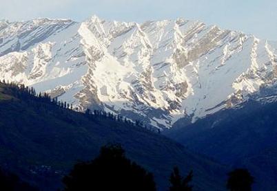
The
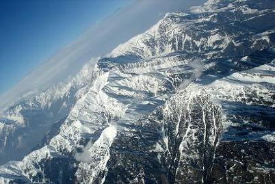
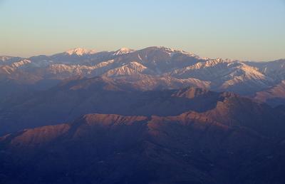
Pir Panjal Range is a group of mountains in the Inner
Himalayan region, running from east-southeast (ESE) to
west-northwest (WNW) across the Indian state of Himachal
Pradesh and the disputed territories comprising Indian
administered Jammu and Kashmir and Pakistan administered Azad
Kashmir, where the average altitude varies from 1,400 m (4,600
ft) to 4,100 m (13,500 ft). The Himalayas show a gradual
elevation towards the Dhauldhar and Pir Panjal ranges.
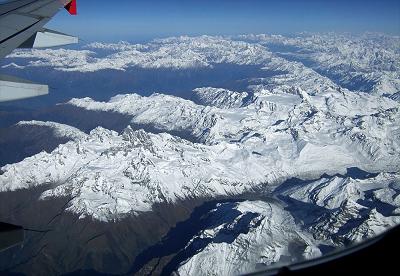
The Pir Panjal Range starts in Ramban and extends westward in
the south of Jammu and Kashmir (Vale of Kashmir) to the last
extremity of Muzaffarabad District. It is 288 km long. Its
width changes between 40 and 50 km. Six historical passes,
Hajipir Pass, Gulabgarh Pass, Ratanpir Pass, Pir Panjal Pass,
Banihal Pass, and Bairam Gala Pass are in this mountain range.
The highest mountain range is Tattakoti. Its elevation is
15,524 feet (4,732 m). The height of this range near Gulmarg
is 12,500 feet (3,800 m) high.
Pir Panjal is the largest range of the lower Himalayas. It
separates itself from the Himalayas near the bank of the
Sutlej river and forms a divide between the rivers Beas and
Ravi on one side and the Chenab on the other. The well-known
Galliat and Murree mountains are also located in this range.
Pīr Panjāl Range is part of the western Punjab Himalayas,
lying in northwestern India and northern Pakistan and it
extends southeastward for more than 200 mi (320 km) from the
Kishanganga to the upper Beās river. It rises sharply to an
average altitude of more than 13,000 ft , it separates the
Jammu Hills to the south from the valley of Kashmir, beyond
which lie the Great Himalayas. The main passes through the
range include the Pīr Panjāl (11,462 ft) and Banihāl (8,985
ft); a highway channel near Banihāl Pass makes the Vale of
Kashmir accessible to traffic from the south, even in winter.
The mountains extending to the north of the Kishanganga River
in Pakistan are sometimes considered part of the range. |
|
| |
|
Passes |
|
The
Pir Panjal pass lies to the west of Srinagar. The Banihal pass
(2,832 m (9,291 ft)) lies at the head of the Jhelum river at the
southern end of the Kashmir valley. Banihal and Qazigund lie on
either side of the pass.The Sinthan pass connects Jammu and
Kashmir with Kishtwar. Pir ki Gali connects Kashmir valley with
Rajouri and Poonch via Mughal road. Pir ki Gali is the highest
point of Mughal road which is about 11500 ft and lies to the
south west of the Kashmir valley. Nearest town to Pir Ki Gali is
Shupian which is the apple town of Kashmir valley.
Munawar pass lies in the North of Pir ki Gali and over looks the
town of Rajouri. Munawar pass observes some of the heaviest
fighting during Operation Gibraltar and was seized by a
Pakistani Force commanded by Major Malik Munawar Khan Awan SJ
who later seized Indian Garrison of Rajouri. The pass was named
after him by the locals.
Rohtang La (altitude 3,978 m (13,051 ft)) is a mountain pass on
the eastern Pir Panjal range which connects Manali in the Kullu
Valley to Keylong in the Lahaul Valley. Haji Pir Pass lies at an
elevation of 2,637 m (8,652 ft) on the western Pir Panjal range
on the road between Poonch and Uri is in the area of Kashmir
administered by Pakistan. |
|
| |
|
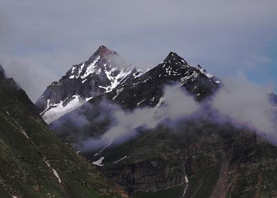
Peaks |
|
Deo
Tibba (6,001 m (19,688 ft)) and Indrasan (6,221 m (20,410 ft))
are two important peaks at the eastern end of the mountain
range. They can be approached from both the Parvati-Beas Valley
(Kulu District) and the Chandra (Upper Chenab) Valley (Lahaul
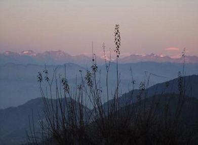
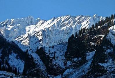
and Spiti District) in Himachal Pradesh. The hill station of
Gulmarg in Kashmir lies in this range. |
|
|
|
|
Tunnels |
|
Road tunnels
Rohtang road tunnel
Rohtang tunnel is being built under the Rohtang Pass in
the eastern Pir Panjal range of the Himalayas on the
Leh-Manali Highway. It has a length of 8.8 km , the tunnel
will be the longest road tunnel in India and is expected
to reduce the distance between Manaliand Keylong by about
60 km . The tunnel is at 3,100 metres elevation whereas
the Rohtang pass is at 3,978 metres elevation. This is one
of the two routes to Ladakh, it lies on the Manali-Leh
axis.
New Banihal road tunnel
Construction of a new 8.45 km long twin-tube
Banihal-Qazigund road tunnel was started in 2011. The new
tunnel is at a lower elevation than the existing Jawahar
tunnel and when completed it would reduce the road
distance between Banihal and Qazigund by 16 km. It would
also be less prone to snow avalanche as it will be at a
lower elevation.
Existing Banihal road tunnel
A 2.5 km (1.6 mi) long tunnel through Pir Panjal mountain
under the Banihal pass connects Banihal with Qazigund on
the other side of the mountain. The tunnel named Jawahar
tunnel, it was founded in early 1950s and commissioned in
December 1956 to ensure snow-free passage throughout the
year. It is at an altitude of about 2,100 m (6,900 ft). It
was designed for 150 vehicles per day but now used by more
than 7,000 vehicles per day. Therefore a new wider and
longer tunnel has been planned at a lower elevation.
Banihal railway tunnel
The Pir Panjal Railway Tunnel is an 11.215 kms railway
tunnel which passes through the Pir Panjal Range in Jammu
and Kashmir. It connects Banihal and Quazigund and is a
part of the Udhampur-Srinagar-Baramulla railway project.
The tunnel was commissioned on 26 June 2013 for regular
service. It is India's longest and Asia's second longest
railway tunnel. |
|
|
|
|
|
|
|
|
|