|
About
Sutlej River |
|
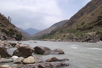
The
Sutlej River is the longest of the five rivers that flow
through the historic crossroad region of Punjab in northern
India and Pakistan. It is located to the north of the Vindhya
Range, south of the Hindu Kush segment of the Himalayas, and
east of the Central Sulaiman Range in Pakistan.
The Sutlej is sometimes known as the Red River. It is the
easternmost tributary of the Indus River. Its source is Lake
Rakshastal in Tibet. From there, it flows at first
west-northwest for about 260 kms to the Shipki La pass,
entering India in Himachal Pradesh state. It then turns
slightly, heading west-southwest for about 360 kms to meet the
Beas River near Makhu, Firozpur district, Punjab state.
Continuing west-southwest, the Sutlej enters Pakistan for
about15 kms east of Bhedian Kalan, Kasur District, Punjab
province, continuing southwest to the ancient and historical
former Bahawalpur princely state.
About 17 kms north of Uch Sharif, the Sutlej unites with the
Chenab River, forming the Panjnad River, which finally flows
into the Indus river about 100 kms west of the city of
Bahawalpur. The area to the southeast on the Pakistani side of
the Indian border is called the Cholistan Desert and, on the
Indian side, the Thar Desert.
The Indus then flows through a gorge near Sukkur and the
fertile plains region of Sindh, forming a large delta region
between the border of Gujarat, India and Pakistan, finally
terminating in the Arabian Sea near the port city of Karachi,
Pakistan.
Contrary to the claims of Punjab state in India, a small part
of Panchkula district in Haryana state is part of the Sutlej
river basin area. Thus, Haryana is also a riparian portion of
the Indus river basin.
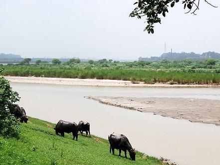
The waters of the Sutlej are allocated to India under the
Indus Waters Treaty between India and Pakistan, and are mostly
diverted to irrigation canals in India. There are several
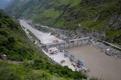
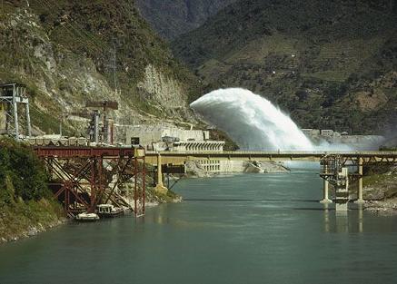
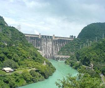
major hydroelectric projects on the Sutlej, including the
1,000 MW Bhakra Dam, the 1,000 MW Karcham Wangtoo
Hydroelectric Plant, and the 1,530 MW Nathpa Jhakri Dam.There
has been a proposal to build a 214-km long heavy freight
canal, known as the Sutlej-Yamuna Link (SYL), in India to
connect the Yamuna and Sutlej rivers. This canal is designed
to connect the entire Ganges, which flows to the east coast of
the subcontinent, with points west via Pakistan. When
completed, the SYL will allow shipping more directly from
India's east coast to its west coast and the Arabian sea
drastically shortening shipping distances and creating
important commercial links for north-central India's large
population. However, the proposal has met with obstacles and
has been referred to the Supreme Court of India. |
|
| |
|
History of Sutlej River |
|
The
Upper Sutlej Valley was once known as the Garuda Valley by the
Zhangzhung, the ancient civilization of western Tibet. The
Garuda Valley was the centre of their empire, which stretched
many miles into the nearby Himalayas. The Zhangzhung built a
towering palace in the Upper Sutlej Valley called Kyunglung, the
ruins of which still exist today near the village of Moincêr,
southwest of Mount Kailash (Mount Ti-se). Finally the Zhangzhung
were occupied by the Tibetan Empire.
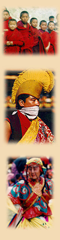
Today, the Sutlej Valley is occupied by nomadic descendants of
the Zhangzhung, who live in tiny villages of yak herders. The
Sutlej was the main medium of transportation for the kings of
that time. In the early 18th century, it was used to transport
devdar woods for Bilaspur district, Hamirpur district, and other
places along the Sutlej's banks. |
|
| |
|
Geology of Sutlej River |
|
There
is substantial geologic evidence to indicate that prior to 1700
BC, and perhaps much earlier, the Sutlej was an important
tributary of the Ghaggar-Hakra River (thought to be the
legendary Sarasvati River) rather than the Indus, with various
authors putting the redirection from 2500-2000 BC, from
5000-3000 BC, or before 8000 BC. Geologists believe that
tectonic activity created elevation changes which redirected the
flow of Sutlej from the southeast to the southwest. If the
diversion of the river occurred recently (about 4000 years ago),
it may have been responsible for the Ghaggar-Hakra (Saraswati)
drying up, causing desertification of Cholistan and the eastern
part of the modern state of Sindh, and the desertion of Harappan
settlements along the Ghaggar. However, the Sutlej may have
already been captured by the Indus thousands of years earlier.
There is some evidence that the high rate of erosion caused by
the modern Sutlej River has persuaded the local faulting and
rapidly exhumed rocks above Rampur. This would be similar to,
but on a much smaller scale than, the exhumation of rocks by the
Indus River in Nanga Parbat, Pakistan. The Sutlej River also
depicts a doubled inverted metamorphic gradient.
Sutlej River, longest of the five tributaries of the Indus River
give the Punjab (meaning “Five Rivers”) its name. It rises on
the north slope of the Himalayas in Lake La’nga in southwestern
Tibet, at an altitude of above 4,600 metres feet (15,000).
Flowing northwestward and then west-southwestward through
Himalayan gorges, it enters and crosses the Indian state of
Himachal Pradesh before beginning its flow through the Punjab
plain near Nangal, Punjab state. Continuing southwestward in a
broad channel, it receives the Beas River and forms 105 km of
the India-Pakistan border before entering Pakistan and flowing
another 350 km to join the Chenab River west of Bahawalpur. The
combined rivers then form the Panjnad, the link between the Five
Rivers and the Indus.
The hydrology of the Sutlej is controlled by spring and summer
snowmelt in the Himalayas and by the South Asian monsoon. The
onset of the summer monsoon brings heavy rains that often
produce extensive flooding downstream. The maximum recorded
flood discharge occurred in 1955, when the river flowed at about
600,000 cubic feet per second. The winter flow is significantly
lower, since there is little rainfall or meltwater from the
Himalayan glaciers. The 1,400 km (900-mile) long Sutlej is used
extensively for irrigation. Its water was a source of dispute
between Pakistan and India until 1960, when the countries
concluded the Indus Waters Treaty, which allocated the water of
the Sutlej to India in exchange for exclusive Pakistani rights
to the Indus and its western tributaries. Major irrigation works
include the Bhakra-Nangal Project, the Sirhind Canal, and the
Sutlej Valley Project, the latter in both India and Pakistan. |
|
|
|
|
Satluj River in Himachal |
|
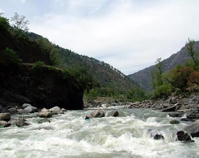
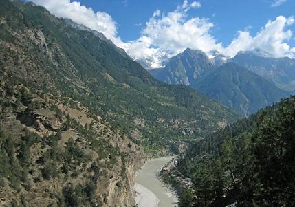
Satluj rises from beyond Indian borders in the Southern
slopes of the Kailash mountain near Mansarover lake from
Rakas lake, as Longcchen Khabab river in Tibet . It is the
largest among the five rivers of Himachal Pradesh. It
enters Himachal at Shipki at an elevation of 6,608 metres
and flows in the South-Westerly direction through Kinnaur,
Shimla, Kullu, Solan, Mandi and Bilaspur districts. Its
course in Himachal Pradesh is 320 km. from Rakastal, with
well-known tributaries viz. the Spiti, the Ropa, the Taiti,
the Kashang, the Mulgaon, the Yula, the Wanger, the Throng
and the Rupi as right bank tributaries, whereas the Baspa,
the Gayathing, the Tirung, the Soldang and the Duling
are left bank tributaries. It leaves Himachal Pradesh to
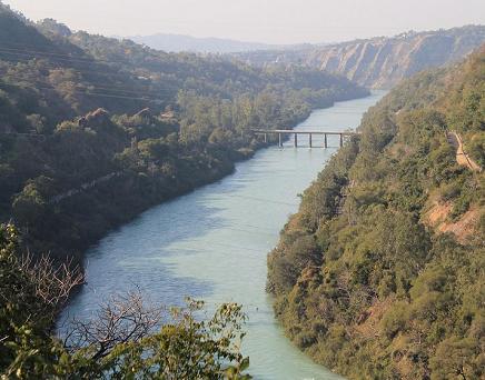
enter the plains of Punjab at Bhakhra, where the world's
highest gravity dam has been constructed on this river.
Its total catchment area in Himachal Pradesh is 20,000 sq.
km. Its vedic name is Satudri and Sanskrit name Shatadru.
The Satluj finally drains into the Indus in Pakistan. The
catchment area of about 50,140 km. of Satluj river is
located above the permanent snow-line at an elevation of
4,500 metres. The upper areas of the Satluj valley are
under a permanent snow cover. The well-known human
settlements that have come on the banks of the Satluj
river are Tattapani, Namgia, Kalpa, Bilaspur, Suni and
Rampur. Its total length is about 1,448 km. |
|
|
|
|
Important Tributaries of Satluj River |
|
Spiti River
The Spiti river originates from Kunzum range and Kabzian and
Tegpo streams are its tributaries. Water draining the famous Pin
valley area are also a part of the Spiti river system. Its
position across the main Himalayan range deprives it from the
benefit of the South-West monsoons that causes extensive rain in
most parts of India from June to September. The river attains
peak discharge in late summers due to glacier melting. After
flowing through Spiti valley, the Spiti river meets Satluj at
Namgia in Kinnaur district crossing a length of about 150 km.
Huge mountain rise to very high elevations on either sides of
the Spiti river and its numerous tributaries. The mountains are
barren and largely devoid of a vegetative cover. The main
settlements along the Spiti river and its tributaries are Hansi
and Dhankar Gompa.
Baspa River
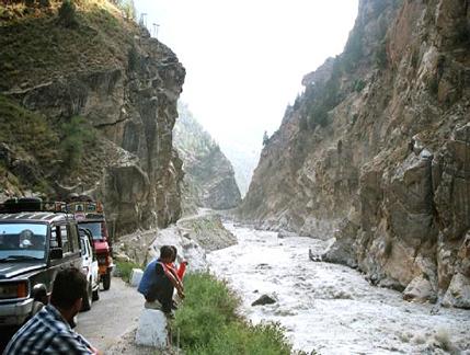
Baspa is an important tributary of the river Satluj in its upper
courses. The Baspa is joined by many smaller channels draining
snow melt waters. The Baspa river has cut across the main
Himalayan range. Thereafter it empties itself into the river
Satluj in district Kinnaur. Baspa originates from the Baspa
hills, joins it from the left bank near Karcham (Kalpa ). Satluj
river leaves Kinnaur district in the West near Chauhra and
enters Shimla district.
Soan River
The Soan river rises from the Southern slopes of the Shivalik
range also known as Solasinghi range in the area to the East of
the Beas gap across the Southern border of the Kangra valley. It
joins the boundary of Punjab and Himachal Pradesh. Its slope is
not very steep and the slopes of the Soan catchment vary from
gentle to steep. In the summer the discharge dropes
considerably, while during monsoon it is in spate.
The Nogli Khad
Nogli Khad joins Satluj just below Rampur Bushahar. It touches
Kullu district in Nirmand tehsil opposite to Rampur tehsil of
Shimla district. The river Satluj enters Mandi district near
Firnu village in the Chawasigarh and passes through the areas of
Mahunm, Bagra, Batwara, Derahat and Dehar. Practically, the
whole of the ancient Suket state except Jaidevi and Balh circles
drains into Satluj. The main tributaries of the Satluj in
district Mandi are Kotlu, Siun, Bhagmati, Bahlu, Siman, Bantrehr,
Khadel and Behna. |
|
|
|
|
|
|
|
|
|