|
|
|
|
Gujarat Tours |
|
|
|
|
|
|
|
|
|
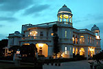
Gujarat Hotels |
|
|
 |
|
|
|
|
Regions of Gujarat |
|
| The main regions of Gujarat are the Kutch and Saurashtra. |
| |
|
Kutch
Kutch is the north westernmost part of Gujarat which is
the least appealing climatically, the most sparsely
populated and off the beaten tourist track. The
various communities such as Rabaris, Ahirs and
Meghwals have a distinct dress and practice a
particular craft. Kutch has a central ridge of
Jurassic sandstones, with underlying basalts
penetrating the beds from place to place. It rises to
a height of between 275 m and 325 m, and like the
plains of the Indus into which it drops almost
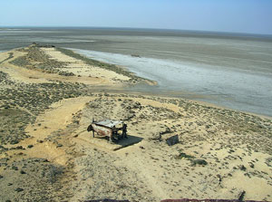
imperceptibly, it is almost desert. To the north of
the ridge is the Great Rann of Kutch, a 20720 square
km salt marsh, which provides a natural boundary with
Pakistan. The Little |
 |
|
|
Rann of Kutch is situated
to the south. The low lying Rann of Kutch in the
north, a part of the Thar Desert, is a hard smooth bed of
dried mud in the dry season Some vegetation exists,
concentrated on the little islands. The herds of the
endangered wild ass that roam on this barren area feed at
night on vegetation at the edge, then retreat inland during
the day. A sanctuary has been created for them but there is
little point contemplating visiting it because it is a
sensitive border area, accommodation is non existent and the
beasts themselves are very rarely seen. With the arrival of
the southwest monsoon in May, the saltwater of the Gulf of
Kutch invades the Rann and Rajasthan rivers pour fresh water
into it. It then becomes an inland sea and very dangerous
for those who get trapped in it. In ancient times armies
have perished there. At this time Kutch virtually becomes an
island. From December to February, it becomes the nesting
ground of flamingoes, sand-grouse and Imperial grouse. The
important activity is the salt production and railway lines
back into the Rann to facilitate the transport of it. |
| |
|
Saurashtra
The Saurashtra or the Kathiawar peninsula is situated
to the south of the Gulf of Kutch and between the Gulf
of Kutch and the Gulf of Cambay. It is approx. 432 kms
long and 320 km wide broadly comprising a basalt
platform, though flanked by sandstone in the north. It
rises from the coast to a complex of low scrub covered
hills at the centre, but it is rarely more than 180 m
high. The two exceptions are to the east of Rajkot and
in the Gir Range. It is formed of intruded igneous
rocks pushed up into the |
 |
|
|
surrounding Deccan lavas,
the resulting plateaus have a completely radial drainage
system. Over most of the Kathiawad are great sheets of
Deccan lavas, cut across by dykes formed of volcanic lava.
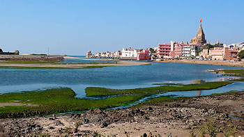
Around the ancient and holy city of Dwaraka in the west and
Bhavnagar in the east are limestone and clays, separated by
a 50 km belt of alluvium. Some is wind blown and at Junagadh
reaches a depth of over 60 m. Spate points out that its
creamy coloured soft stone is widely used as Porbandar
stone. There are no major rivers and many of the
watercourses are seasonal. |
|