|
About Indus River |
|
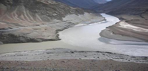
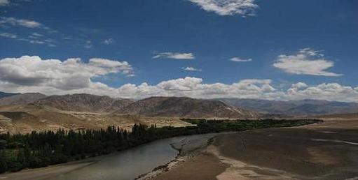
The Indus River flows from Tibet, into Jammu and Kashmir and
the rest of Pakistan. The river is the greatest river on the
western side of the subcontinent, and is one of the seven
sacred rivers of Hindus. It was the birthplace of the early
Indus Valley civilization.
The total length of the river is 3,180 km (1,980 mi). It is
Pakistan's longest river. The river has a total drainage area
more than 1,165,000 km2 (450,000 sq mi). Its estimated annual
flow stands at around 207 km3 (50 cu mi), which makes it
twenty-first largest river in the world in terms of annual
flow. |
|
| |
|
History of
Indus River |
|
Paleolithic sites have been discovered in Pothohar near
Pakistan's capital Islamabad, with the stone tools of the Soan
Culture. In ancient Gandhara, near Islamabad, evidence of cave
dwellers dated 15,000 years ago has been discovered at Mardan.
The major cities of the Indus Valley Civilization, such as
Mohenjo-daro and Harappa date back to around 3300 BC, and
represent some of the largest human habitations of the ancient
world. The Indus Valley Civilization extended from across
Pakistan and northwest India, with an upward reach from east of
Jhelum River to Ropar on the upper Sutlej. The coastal
settlements extended from Sutkagan Dor at the Pakistan, Iran
border to Kutch in modern Gujarat, India. There is an Indus site
on the Amu Darya at Shortughai in northern Afghanistan, and the
Indus site Alamgirpur at the Hindon River is situated only 28 km
(17 mi) from Delhi. To date, over 1,052 cities and settlements
have been found, mainly in the general region of the
Ghaggar-Hakra River and its tributaries. Among the settlements
were the major urban centers of Harappa and Mohenjo-daro, as
well as Lothal, Dholavira, Ganeriwala, and Rakhigarhi. Only
90-96 of the over-800 known Indus Valley sites have been
discovered on the Indus and its tributaries. The Sutlej, now a
tributary of the Indus, in Harappan times flowed into the
Ghaggar-Hakra River, in the watershed of which were more
Harappan sites than along the Indus.Most scholars believe that settlements of Gandhara grave culture
of the early Indo-Aryans flourished in Gandhara from 1700 BC to
600 BC, when Mohenjo-daro and Harappa had already been
abandoned.
The word "India" is derived from the Indus River. In ancient
times, "India" initially referred to those regions immediately
along the east bank of the Indus, but by 300 BC, Greek writers
including Megasthenes were applying the term to the entire
subcontinent that extends much farther eastward.
The lower basin of the Indus forms a natural boundary between
the Indian subcontinent and the Iranian Plateau ; this region
embraces all or parts of the Pakistani provinces Balochistan,
Khyber Pakhtunkhwa, Punjab and Sindh and the countries
Afghanistan and India. It was crossed by the invading armies of
Alexander, but after his Macedonians occupied the west
bank—joining it to the Hellenic Empire, they elected to retreat
along the southern course of the river, ending Alexander's Asian
campaign . The Indus plains were later dominated by the Persian
empire and then the Kushan empire. Over several centuries Muslim
armies of Muhammad bin Qasim,Mahmud of Ghazni, Mohammed Ghori,
Tamerlane and Babur crossed the river to attack the inner
regions of the Punjab and points farther south and east. |
|
| |
|
Geology of
Indus River |
|
The Indus river feeds the Indus submarine fan, which is the
second largest sediment body on the Earth at around 5 million
cubic kilometres of material eroded from the mountains. Studies
of the sediment in the modern river signify that the Karakoram
Mountains in India and northern Pakistan are the single most
vital source of material, with the Himalayas that provides the
next largest contribution, mostly via the large rivers of the
Punjab (Jhelum, Ravi, Chenab, Beas and Sutlej). Analysis of
sediments from the Arabian Sea has demonstrated that prior to
five million years ago the Indus was not linked to these Punjab
rivers which instead flowed east into the Ganges and were
captured after that time.Earlier work showed that sand and
silt from western Tibet was reaching the Arabian Sea by 45
million years ago, implying the existence of an ancient Indus
River by that time.The delta of this proto-Indus river has
subsequently been found in the Katawaz Basin, on the
Afghan-Pakistan border. |
|
|
|
|
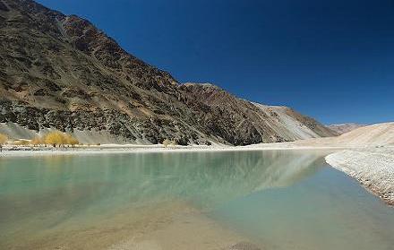
Wildlife of Indus River |
|
Accounts of the Indus valley from
the times of Alexander's campaign signify a healthy forest
cover in the area, which has now considerably receded.The
Mughal Emperor Babur writes of encountering rhinoceroses
along its bank in his memoirs (the Baburnama). Extensive
deforestation and human interference in the ecology of the
Shivalik Hills has led to a marked decline in vegetation
and growing conditions.The Indus valley regions are arid
with poor vegetation. Agriculture is sustained largely due
to irrigation works. Indus river and its division has a
rich biodiversity. It is home to around 25 amphibian
species and 147 species, 22 of which are only found in the
Indus. |
|
|
|
|
People
of
Indus River |
|
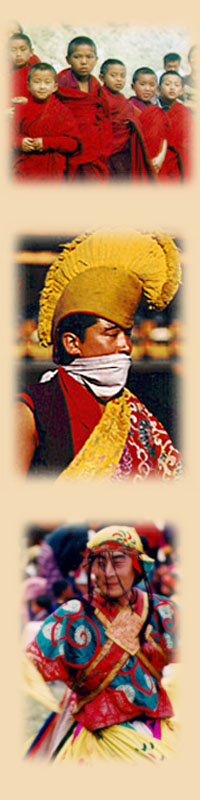
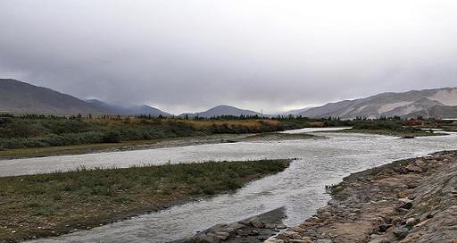
The inhabitants of the regions through which the Indus river
passes and forms a major natural feature and resource are varied
in custom, religion, national and linguistic backgrounds. On the
northern course of the river in the state of Jammu and Kashmir
in India, the Buddhist people of Ladakh live, and the Dards of
Indo-Aryan or Dardic stock and practising Buddhism and Islam.
Then it descends into Baltistan, northern Pakistan passing the
main Balti city of Skardu. On its course river from Dubair Bala
also drains into it at Dubair Bazar. People living at this area
are mainly Kohistani and speak Kohistani language. Major areas
through which Indus river pass through in Kohistan are Dubair,
Pattan and Dasu. As it continues through Pakistan, the Indus
river forms a unique boundary of ethnicity and cultures - upon
the western banks the population is largely Pashtun, Baloch, and
of other Iranian stock, with close cultural, economic and ethnic
ties to eastern Afghanistan and parts of Iran. The eastern banks
are largely populated by people of Indo-Aryan stock, such as the
Sindhis and the Punjabis.In northern Punjab and the Khyber Pakhtunkhwa, ethnic Pashtun tribes live alongside Dardic people
in the hills Khowar, Kalash, Shina, etc., Burushos in Hunza, and
Punjabi people.In the province of Sindh, people of Sindhi
backgrounds form the local populations.Upon the western banks
of the river live the Baloch and Pashtun people of Balochistan. |
|
|
|
|
Mammals and Fish |
|
The blind Indus River Dolphin is a sub-species of dolphin that
was found only in the Indus River. It formerly also occurred in
the tributaries of the Indus river.According to the World
Wildlife Fund claims it is one of the most threatened cetaceans
with only about 1000 still existing.
Palla fish Tenualosa ilisha of the river is a weakness for
people living along the river.The population of fishes in the
river is moderately high, with Kotri , Thatta and Sukkur,being
the major fishing centres - all in the lower Sindh course. But
irrigation and damming has made fish farming a vital economic
activity. Positioned southeast of Karachi, the large delta has
been recognised by conservationists as one of the world's most
vital ecological regions. Here the river turns into many
marshes, streams and creeks and meets the sea at shallow levels.
Here marine fishes are found in plenty, including prawns and
pomfret. |
|
|
|
|
Indus
River Economy |
|
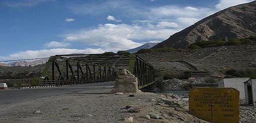
The Indus is the most significant supplier of water resources to
the Sindh plains and Punjab - it forms the backbone of
agriculture and food production in Pakistan. The river is
especially critical since rainfall is inadequate in the lower
Indus valley. Irrigation canals were first constructed by the
people of the Indus valley civilization, and later by the
engineers of the Mughal Empire and the Kushan Empire.Modern
irrigation was introduced by the British East India Company in
1850 - the construction of modern canals accompanied with the
restoration of old canals. The British supervised the
construction of one of the most complex irrigation networks in
the world. The Guddu Barrage is 1,350 m (4,430 ft) long -
irrigating Jacobabad ,Sukkur, Larkana, and Kalat. The Sukkur
Barrage serves over 20,000 km2 (7,700 sq mi).
After Pakistan came into existence, a water control treaty
signed between Pakistan and India in 1960 guaranteed that
Pakistan would receive water from the Indus River and its two
tributaries the Chenab River & the Jhelum River independently
of upstream control by India. The Indus Basin Project consisted
primarily of the construction of two main dams, the Tarbela Dam
constructed on the Indus River and the Mangla Dam built on the
Jhelum River, together with their subsidiary dams. The Pakistan
Water and Power Development Authority undertook the construction
of the Chashma-Jhelum link canal - connecting the waters of the
Jhelum and Indus rivers - extending water supplies to the
regions of Bahawalpur and Multan. Pakistan constructed the
Tarbela Dam near Rawalpindi - standing 2,743 metres (9,000 ft)
long and 143 metres (470 ft) high, with an 80-kilometre (50 mi)
long reservoir.
Walnuts grow along the Indus near Skardu, and poplars and
apples; there are tasty melons and nectarines and apricots in
the valley of Shigar, but it is hard to send them "down-country"
because they are easily spoilt in journey. Maize , Potatoes and
other crops need constant attention; the patchwork of fields
must be fed by small water-channels led off from the upper
streams of the Indus, sometimes for hundreds of yards. This
means endless, back-breaking work in moving boulders to dam icy
water, in continually checking, adjusting and repairing the
flimsy clay dykes. Strong winds funnel along the river, and the
fine soil blows away and must be replaced. At this height, the
growing season is short, and everyman, woman and child is
pressed into service. Below Skardu, the Karakorams and Himalayas
close in towards the Indus.
|
|
|
|
|
Indus
River Tributaries |
|
Tributaries of
Indus River are as follows-
1)
Nagar River
2)
Astor River
3)
Balram River
4)
Dras River
5)
Gar River
6)
Ghizar River
7)
Gilgit River
8)
Gomal River
9)
Kabul River
10) Kurram River
11) Panjnad River
12) Shigar River
13) Shyok River
14) Soan River
15) Tanubal River
16) Zanskar River |
|
|
|
|
Description |
|
The Indus River provides key water
resources for the economy of Pakistan - especially the
Breadbasket of Punjab province, which accounts for most of
the nation's agricultural production, and Sindh.The word
Punjab means "water of five rivers" and the five rivers are Sutlej , Beas , Ravi ,Jhelum, and Chenab all of which
finally merge in Indus.The Indus also supports many heavy
industries and provides the main supply of potable water in
Pakistan.
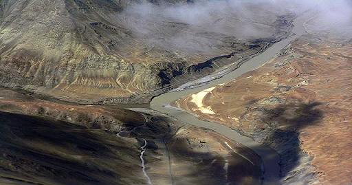
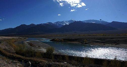
The ultimate source of the Indus is in Tibet; it starts at
the confluence of the Sengge and Gar rivers that drain the
Nganglong Kangri and Gangdise Shan mountain ranges.The
Indus then flows northwest through Ladakh and Baltistan into
Gilgit, just south of the Karakoram range. The Shigar ,
Gilgit and Shyok rivers carry glacial waters into the main
river. It gradually bends to the south, coming out of the
hills between Rawalpindi and Peshawar.The Indus passes
gigantic gorges 4,500–5,200 metres (15,000–17,000 feet) deep
near the Nanga Parbat massif.It flows swiftly across Hazara
and is dammed at the Tarbela Reservoir. The Kabul River
joins it near Attock.The remainder of its route to the sea
is in the plains of the Punjab and Sindh, where the flow of
the river becomes slow and highly braided. It is joined by
the Panjnad at Mithankot. Beyond this confluence, the river,
at one time, was named the Satnad River (sat = "seven", nadī
= "river"), as the river was now carrying the waters of the
Kabul River, the Indus River and the five Punjab rivers.
Passing by Jamshoro, it ends in a large delta to the east of
Thatta.
The Indus is one of the few rivers
in the world to exhibit a tidal bore.The Indus system is
largely fed by the snows and glaciers of the Himalayas, Karakoram and the Hindu Kushranges of Tibet, the Indian
state of Jammu and Kashmir and the Northern Areas of
Pakistan respectively.The flow of the river is also
determined by the seasons - it diminishes greatly in the
winter, while flooding its banks in the monsoon months from
July to September.There is also evidence of a steady shift
in the course of the river since ancient times - it deviated
westwards from flowing into the Rann of Kutch and adjoining
Banni grasslands after the 1816 earthquake.
The traditional source of the
river is the Senge Khabab or "Lion's Mouth", a perennial
spring, not far from the sacred Mount Kailash, and is marked
by a long low line of Tibetan chortens.There are various
other tributaries nearby which may possibly form a longer
stream than Senge Khabab, but unlike the Senger Khabab, are
all dependent on snowmelt.The Zanskar River which flows
into the Indus in Ladakh has a greater volume of water than
the Indus itself before that point. |
|
|
|
|
Indus River
Basin |
|
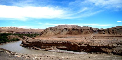
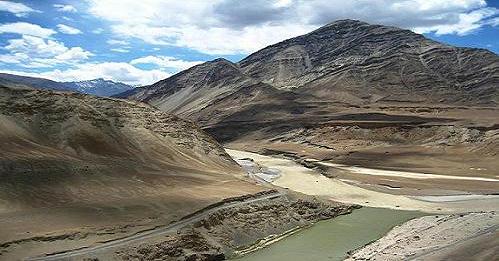
The upper reaches of the Indus and its tributaries extend over a
huge area from Tibet and northern India to the east and
Afghanistan and Pakistan to the west.The lower reaches of the
river are completely in Pakistan.Over 60% of the total area of
the Indus basin is in Pakistan and Pakistan-administered
Kashmir.India-Administered Kashmir, has about 15%, Tibet has
about 10% and the Republic of India and Afghanistan each have
about 7% of the Indus basin catchment area.
The Indus water system of rivers comprises the main Indus and
its major tributaries: the Kurram River and Kabul River on the
right bank, and the Chenab River , Ravi River ,Jhelum River,
Beas River and the Sutlej on the left.The first two join the
Indus soon after it leaves the mountains, and the others lower
down in the plains. The whole of the Beas and the head reaches
of the Ravi and Sutlej are in the Republic of India, while those
of the Jhelum and Chenab lie mostly in the Kashmir state. |
|
|
|
Indus River
Course |
|
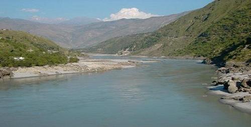
Rising in western Tibet, the Indus runs at first across a high
plateau, then the ground falls away and the river, dropping
rapidly, gathering momentum and rushing north-west, collects the
waters from numerous glacier-fed streams, and runs north-west
between the world's greatest mountain ranges, the Karakoram and
the Himalayas.In Kashmir it crosses the United Nations
cease-fire line and, in Baltistan District, enters
Pakistan-Administered Kashmir. |
|
|
|
|
|
|
|
|
|