|
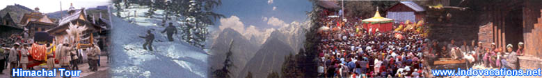
About
Kinnaur |
|
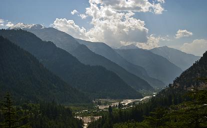
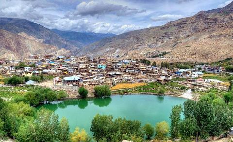
Kinnaur is one of twelve administrative districts in the
Indian state of Himachal Pradesh, India. The district is
divided into three administrative areas – Pooh, Kalpa, and
Nichar – and has five tehsils (counties). The administrative
headquarters of Kinnaur district is at Reckong Peo. From here
Kinnaur Kailash, considered to be the abode of Lord Shiva, can
be viewed. As of 2011 it is the second least crowded district
of Himachal Pradesh out of 12 after Lahaul and Spiti. There
are nine vital languages which are spoken in the district.
As the region was unreachable there used to be very little
interaction with people from the plains and, therefore, the
ancient Hindu texts considered spiritual Kinnars as halfway
between humans and gods! According to the 2011 census Kinnaur
district has a population of 84,298.
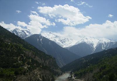
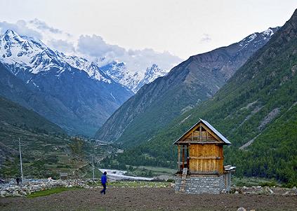
Kinnaur is surrounded by the Tibet to the east, it is in the
northeast corner of Himachal Pradesh, about 235 km from the
state capital, Shimla. It has three high mountains ranges,
namely, Himalayas, Zanskar and Dhauldhar that surround valleys
of Spiti, Sutlej, Baspa and their tributaries. The slopes are
covered with orchards, thick wood, fields and pretty villages.
The religious Shivling lies at the peak of Kinnaur Kailash
mountain. The district was opened for the outsiders in 1989.
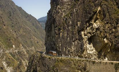
The old Hindustan-Tibet Road passes through the Kinnaur valley
along the bank of river Sutlej and finally enters Tibet at
Shipki La pass.
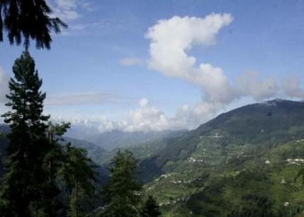
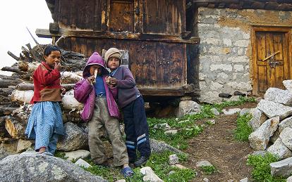
It is not only the scenic beauty which appeals to the young
and old alike but also the life styles of the people, their
heritage, culture, customs and traditions. The people have
strong culture and beliefs, generally follow Hinduism and
Buddhism, believing the Pandavas came and resided in the land
while in the exile. Thousands-year-old monasteries still exist
in the area. Buddhists and Hindus live in harmony symbolizing
the traditional friendship and brotherhood of the people of
both the faiths. Apples, chilgoza (chestnut) and other dry
fruits are grown here. The high landscape here facilitates
adventures and sports. Trekking routes include the 'Parikarma
of Kinnaur Kailash'. |
|
| |
|
History of Kinnaur |
|
Little is known about the history of Kinnaur, except for the
fact that it was once known as Kanaurra or Kinnaura. However
there are legends and myths among the inhabitants.
It is known that the area was placed under the control of the
Magadha kingdom, followed by the Mauryan Empire during the 6th
century BCE, which was then occupied mainly by the Panasika,
Valhika, Kamboja, and Kirata. Kinnaur also came under the
influence of the Guge kingdom of Tibet between the 9th and 12th
centuries.
Kinnaur was later divided into seven parts, known as Sat Khund.
Conflicts in the region finally gave rise to the formation of
many small chiefdoms, which fought amongst one another for
power. These struggles also included the neighbouring Bhotes.
Several forts from this time, including Moorang, Kamru and
Labrang serve as evidence of the region's history of conflict,
which lasted until Emperor Akbar conquered the area. Akbar's
conquest resulted in the incorporation of the Kinnaur valley
into the Mughal Empire.
After the collapse of the Mughal Empire, the Kinnaur valley,
then known as Chini Tehsil, played an influential role. When its
dominant role in the region lapsed, it was merged to form part
of the Mahasu district. By 1960, political, ethnic, and cultural
considerations led to the area being reorganised, forming the
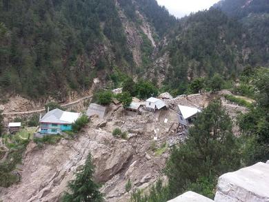
present Kinnaur district. In 1975 an earthquake struck the
region.
Culture of Kinnaur is Tribal and fraternal polyandry is still
present. This practice of polyandry was introduced in old times
to balance survival as cultivated land is less and family
planning was unheard. But with change of time and impact of
education, now it is found it traces. |
|
| |
|
Geography of Kinnaur |
|
A
mountainous area, ranging in altitude from 2,320 to 6,816 metres
(7,610 to 22,362 ft), Kinnaur is one of the smallest districts
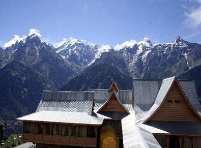
in India by population. It is famous for the Kinnaur Kailash, a
mountain sacred to Hindus, close to the Tibetan border.
Flora and fauna
Portions of Kinnaur are situated high in the Himalaya, where
vegetation is thin and consists primarily of hardy grasses.
Alpine species such as pine, fir, juniper, rhododendron and
cypress can be found at elevations between 3,500 and 5,000
metres, mainly in Middle Kinnaur. At lower altitudes,
temperate-climate trees are found, including maple, magnolia,
oak, chestnut, birch, alder, apple, andapricot. Dzos and Yaks are reared by local farmers in the higher areas.
Scattered populations of the Himalayan black bear and small
ponies may also be found. |
|
|
|
|
Climate of Kinnaur |
|
Most of Kinnaur enjoys a temperate climate due to its high
elevation, with long winters from October to May (the
snowy season), and short summers from June to September
due to the Geographical conditions. From April to May is
Spring and September to October is Autumn. Only the Baspa
valley, lower region of the Satluj valley and the area
south of the Great Himalaya receives monsoon rains, while
in the upper areas monsoon showers progressively
decreases. |
|
|
|
|
Adventure Tourism in Kinnaur |
|
Kinnaur has tremendous scope of adventure tourism. There are
many trekking routes in the district. Ski slopes are available
at Kalpa and rock climbing can also be started in this district.
Walking has been a means of leisure and physical fitness.
Trekking is essentially walking. In ancient times people walked
through the dense, untouched forests and they walked across
unknown passes and mountains in search of grazing grounds and
game. Numerous passes connect the two valleys across the range.
These passes have legends and even today they are mysterious,
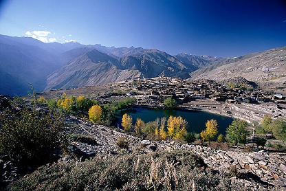
illuminating and challenging to the world. The valleys have some
of the most interesting view points, lakes, meadows and lush
green pastures to add to its mystery and beauty. |
|
|
|
|
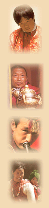
People of Kinnaur |
|
Kinnaur district may be classified into three territorial units.
Lower Kinnaur comprise area between Chora at the boundary of the
Kinnaur district with Rampur Bushahr and Kalpa including Nichar
and Sangla valleys. The people of Lower Kinnaur are primarily of
the Mediterranean physical type. It is difficult to distinguish
them from the people residing in the adjoining Shimla district
with whom they have some similarity. The people of lower Kinnaur
are mostly Hindus though the ethno-historical factors have
resulted in growing Buddhist influence.
The middle Kinnaur is the area between Kalpa and Kanam including
Moorang tehsil. The people of middle Kinnaur are of mixed ethnic
strain. Some have marked Mongoloid and others marked
Mediterranean features. In some cases there is an admixture of
the above two in varying degrees. The inhabitants are Buddhist
as well as Hindus. Many people have faith in both the religions.
It is very common to see Buddhist flag in most houses.
The upper Kinnaur comprises remaining north-eastern part of the
district i.e. the area between Poo (town) and Hangrang valley
extending up to international border with Tibet. The predominant
physical type of upper Kinnaur is the Mongoloid though a few
persons with Mediterranean features are also seen in the area
around Poo. Some persons show the blending of Mediterrean and
Mongoloid elements in varying degrees. However the people of
Hangrang valley are almost universally Mongoloids. They mostly
follow Mahayana Buddhist religion. The Kannaurs are very fond of
music, dance and singing. |
|
|
|
|
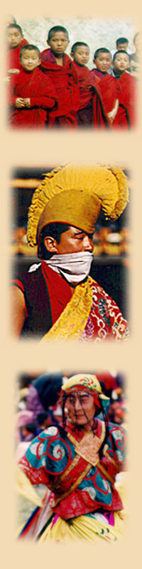
Religion |
|
The
people of lower Kinnaur are mostly Hindu. Their most important
gods and goddess are Durga (Chandi), Bhairon, Usha (Ukha),
Narayan, Vishnu, Badrinath and Bhimakali. The Chamang and Domang
have their favorite deities such as Nag Devta. In addition, each
village has its presiding deity.
The inhabitants of middle Kinnaur are Buddhist as well as Hindu.
The important Hindu deities of middle Kinnaur include Chandi,
Gauri Shankar, Kansa and Narayanjee. Dabla, the local god of
Kanam village, has certain features traditionally associated
with the Bon religion.
The religion of upper Kinnaur is mostly Tibetan Buddhist. Almost
every village has a monastery with monks recruited from amongst
the (Kanet).Hinduism is the main religions in the district
followed by Tibetan Buddhism, although Bön is also practised.
These three religions have undergone religious mixing, along
with some indigenous shamanistic practices.
The Kinnaur Kailash is the most sacred mountain for most
Kinners. Every year it is visited by thousands of locals on
religious pilgrimages known as Yatra, Hindu and Buddhist alike.
|
|
|
|
|
Lifestyle |
|
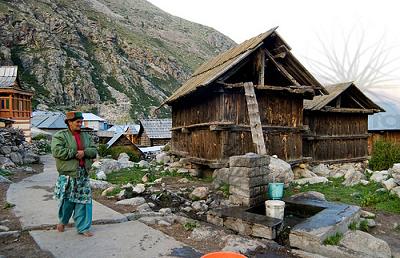
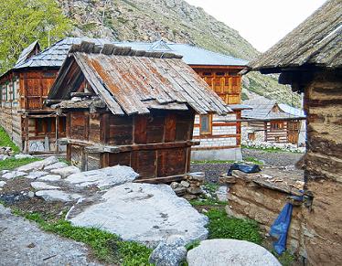
Generally, Kinner houses have storerooms for keeping grain and
dried fruits, and separate wooden grain-storage structures,
called kathar. Pakpa, a piece of sheepskin or yakskin, is often
placed on the khayarcha mat.Traditionally Kinners use utensils
made of brass and bronze. Modern influences have included the
introduction of Chinese crockery, and utensils made of stainless
steel and aluminum.
Clothes are mainly of wool. The thepang, a grey woollen cap, is
worn with a white velvet band. The Tibetan chhuba, a long
woollen coat which resembles an achkan, is worn as well, with a
sleeveless woollen jacket. While men wear woollen churidhar
pajamas, and tailored woollen shirts such as the chamn kurti,
the women wrap themselves up in a dohru. The first wrap of the
dohru is based on the back, with embellished borders displayed
throughout its length, which extends to the heels. Darker shades
of colours are preferred for the Dohru, although other
beautifully coloured shawls may be worn, usually draped over the
shoulders. A choli, another type of full sleeved blouse worn by
women, may serve as a decorative lining as well. |
|
|
|
|
Best Time to Visit Kinnaur |
|
Kinnaur is a beautiful district to visit. Great natural
scenes, high mountains, valleys, rivers, lakes and green
pastures creates an exciting scenes for tourists. Best time
to visit the district is from April to October. |
|
|
|
|
How To Reach Kinnaur |
|
By
Rail
There is no Rail service to Kinnaur and the nearest Railway
Station at Shimla is connected by a narrow gauge line from Kalka
which is about 96 Km from shimla.
By Road
Reckong Peo, the District Headquarters of Kinnaur is 235 Kms
from Shimla. National Highways -22 is the most convenient
communication network to Kinnaur. For those who can afford it,
jeep and taxies are the best way to go to Kinnaur.
By
Air
There is no direct flight to Kinnaur and the nearest Airport is
Shimla which can be reached from Delhi. |
|
|
|
|
|
|
|
|
|